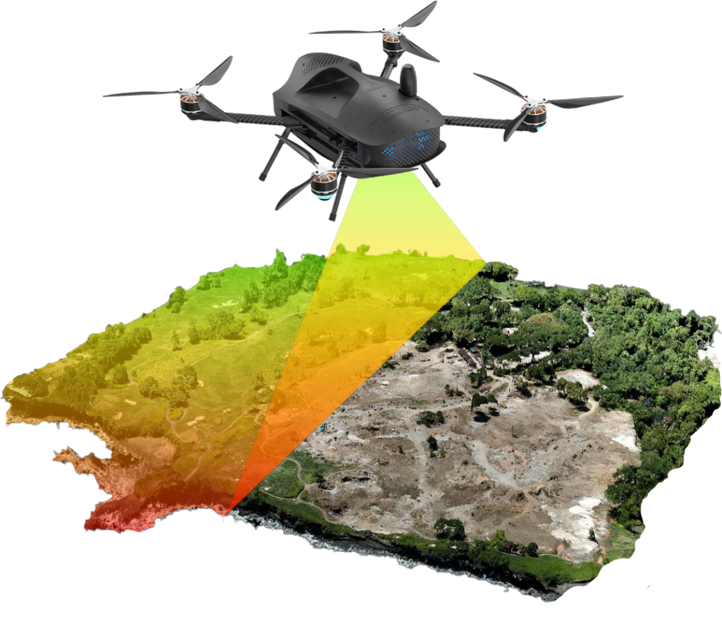
Mapping the Future with GIS, Drone & LiDAR
Kaidron Spatial Systems is a professionally driven geospatial services company providing reliable, high-quality backend support for mapping and spatial projects across both government and private sectors. We collaborate closely with drone pilots, survey teams, and infrastructure partners, transforming raw spatial data into accurate, clear, and actionable outputs that enable confident decision-making. Our experience across diverse projects has earned us a strong reputation for precision, consistency, and timely delivery. At Kaidron, every client and every project receives focused attention. We take the time to understand real-world requirements and ensure our final deliverables align seamlessly with practical project needs. With a strong commitment to quality, confidentiality, and long-term collaboration, Kaidron Spatial Systems goes beyond service delivery—we act as a trusted backend partner clients can rely on.
At Kaidron Spatial Systems, we go beyond standard geospatial services by delivering dependable backend support built on precision, responsibility, and partnership.
We convert raw spatial data into highly accurate, clear, and usable deliverables that support confident decision-making.
Every project is handled with dedicated attention, ensuring solutions are tailored to real requirements—not generic workflows.
We work as a trusted backend extension of your team, delivering consistent quality, confidentiality, and on-time results.
Our clients trust Kaidron Spatial Systems for our accuracy, consistency, and dependable backend support. From drone data processing to large-scale mapping projects, we are recognized for delivering clear, high-quality spatial outputs that meet real project requirements.
Kaidron Spatial Systems delivered highly accurate geospatial outputs that integrated seamlessly into our project workflow. Their precision, reliability, and timely delivery made them a valuable backend partner
Their ability to transform raw spatial data into clear, usable deliverables saved our team significant time. Kaidron’s attention to detail and quality control truly stands out.
We work behind the scenes to transform complex drone, survey, and mapping data into clear, usable outputs that teams can trust and act upon.
+91 9994894714
info.kaidronspatial@gmail.com