EXPLORE

Precision Drone Mapping & Orthomosaic Solutions

We generate high-resolution, accurately georeferenced Orthomosaic maps by processing raw drone imagery. Our Orthomosaic provide seamless, distortion-free ground views that support precise measurement, mapping, and analysis for infrastructure, construction, agriculture, and land management projects.

Digital Elevation & Surface Modeling (DEM/DSM)

We generate accurate DEM/DSM from drone data to represent terrain and surface features with high precision. These outputs are widely used for terrain analysis, volume estimation, drainage studies, and infrastructure planning.

Contour Mapping & Terrain Analysis

We generate accurate 2D and 3D contour maps from high-resolution drone-derived elevation data to clearly represent terrain undulations and slope variations. These contours enable detailed site assessment, support engineering design, cut–fill calculations, drainage planning, and informed decision-making for infrastructure, construction, and land development projects.

LiDAR Classification & Terrain Modeling (DTM)

We perform detailed classification of LiDAR point cloud data to accurately separate ground, vegetation, buildings, and other surface features. From the classified data, we extract high-precision Digital Terrain Models (DTM) that represent true ground elevation, supporting terrain analysis, flood modeling, infrastructure planning, and large-area mapping projects.

LiDAR Classification

DTM

GIS Mapping
(Infrastructure and Utilities)

We deliver accurate GIS mapping solutions for infrastructure and utility networks, including roads, buildings, pipelines, drainage, and electrical assets. Our maps integrate spatial data, field inputs, and engineering drawings to support asset management, planning, monitoring, and decision-making for urban and infrastructure projects.

Topographic Mapping & CAD Engineering Deliverables

We provide accurate CAD digitization and detailed topographic mapping by converting survey data, drone outputs, and existing drawings into well-structured CAD deliverables. Our maps clearly represent contours, spot levels, utilities, and surface features, enabling reliable engineering design, quantity estimation, planning, and construction execution.

Drone-Based 2D & 3D Surveying

We conduct high-accuracy 2D and 3D drone surveys integrated with DGPS-based ground control points to ensure precise georeferencing and reliable results. Our surveys deliver accurate spatial data for mapping, volumetric analysis, and engineering applications across construction, infrastructure, and land development projects.

LiDAR Point Cloud Processing & 3D Mesh Modelling

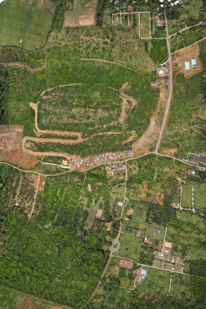
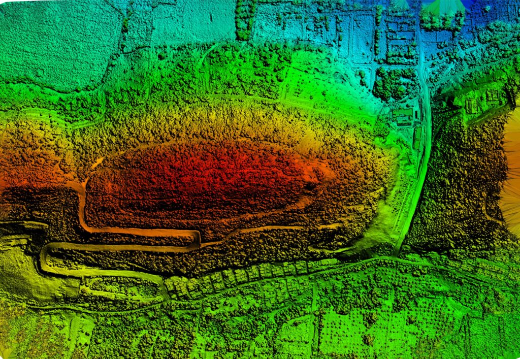
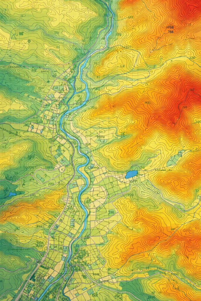
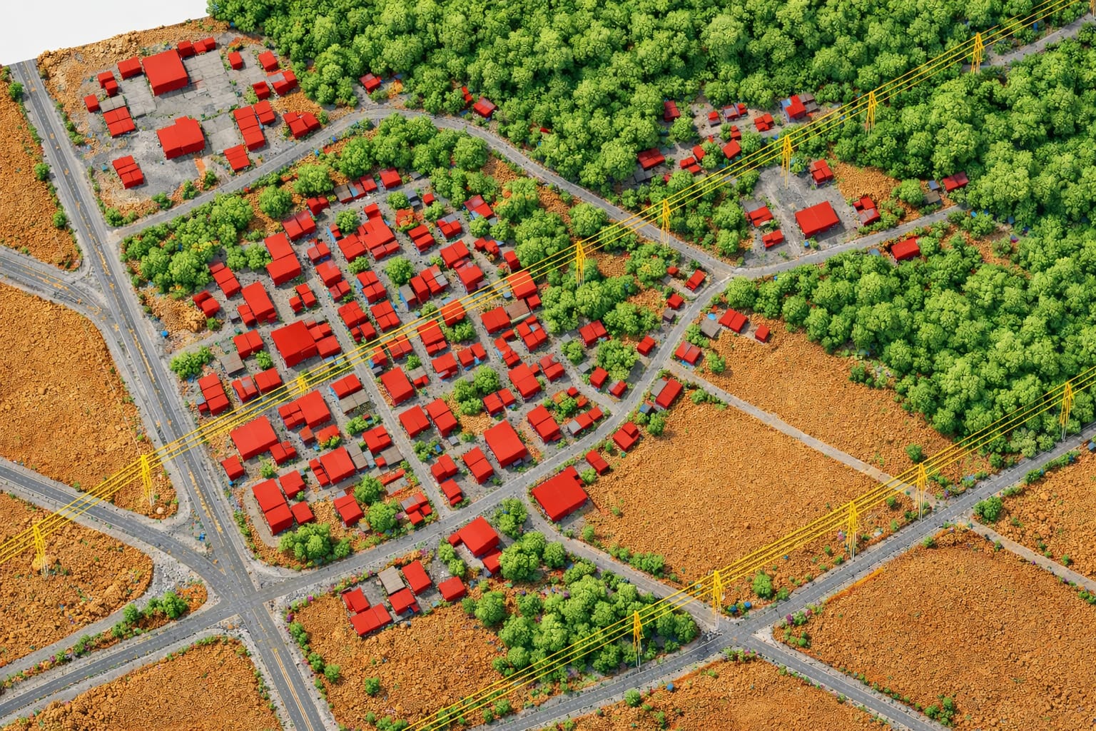
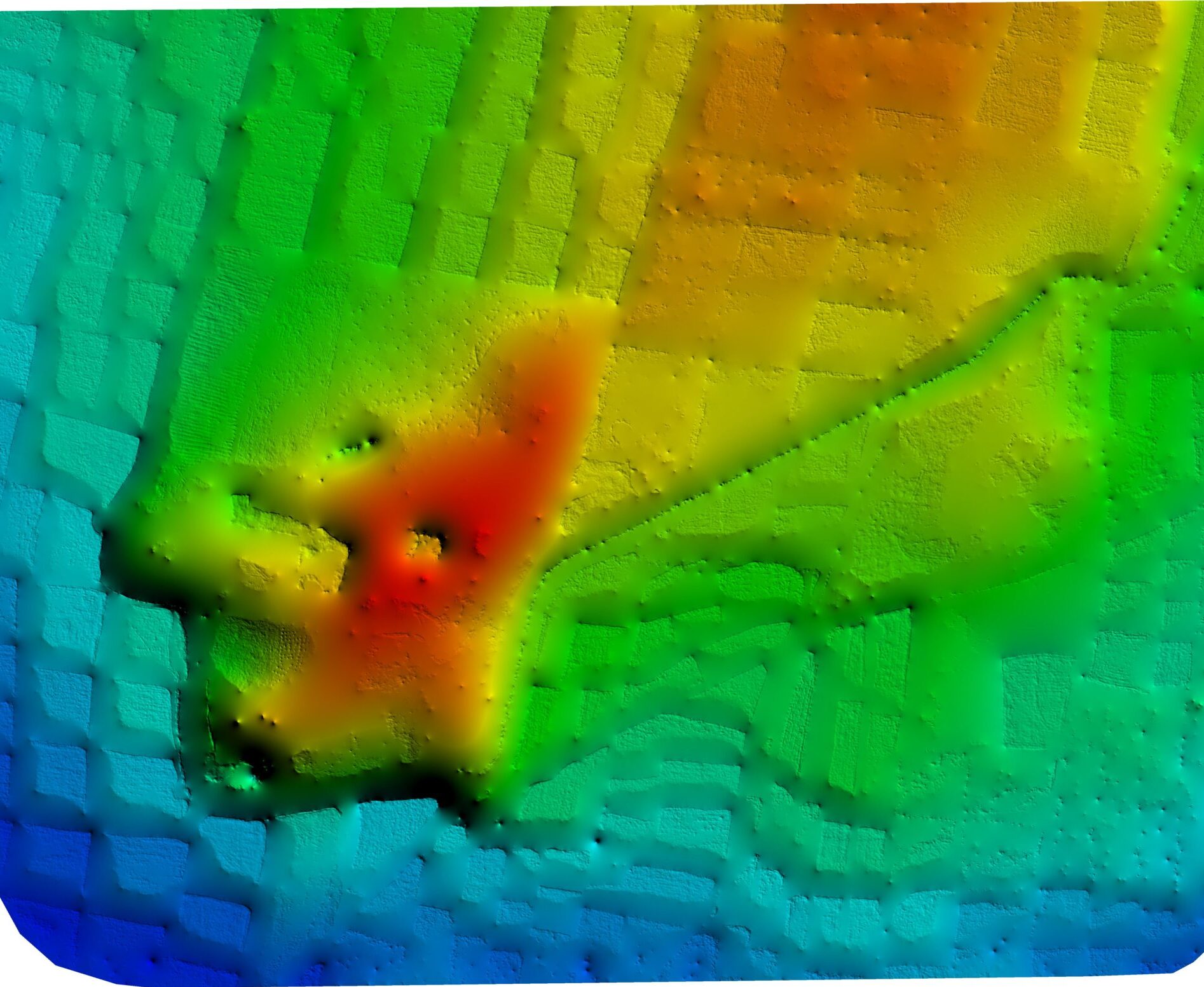
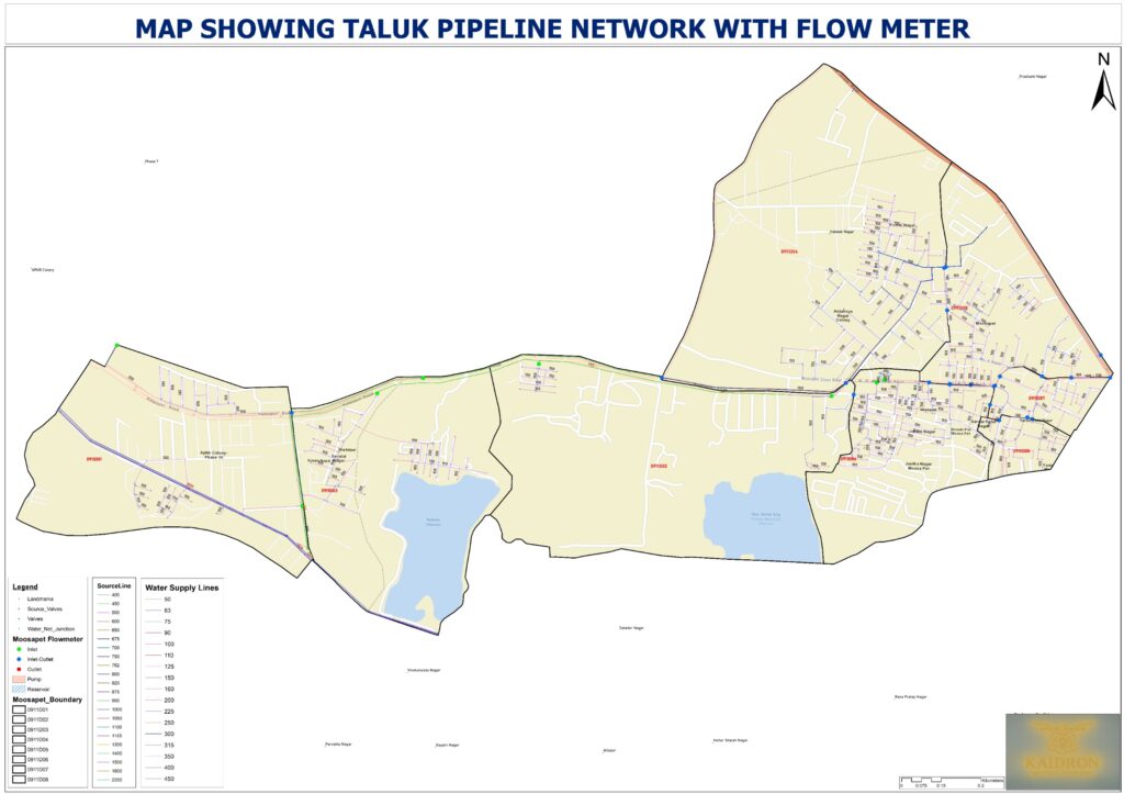
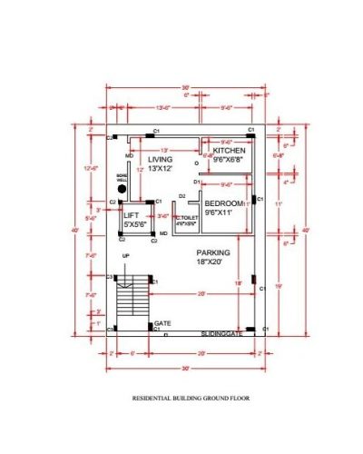
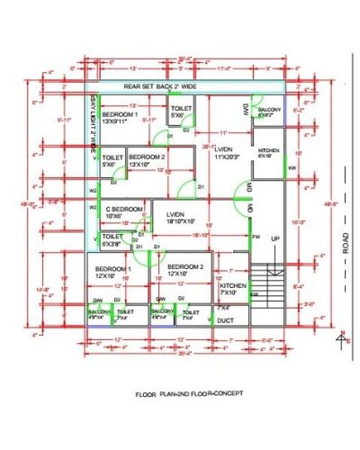
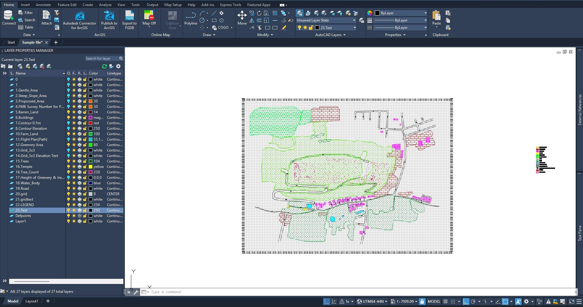
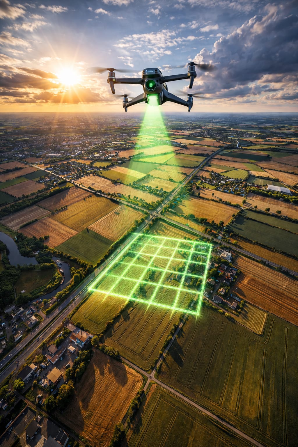
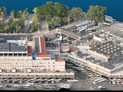
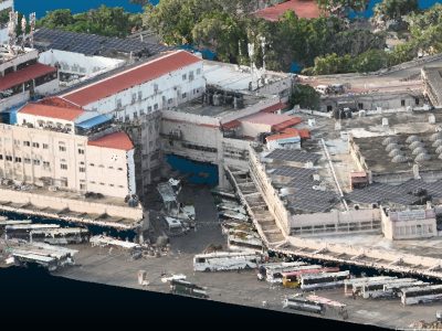
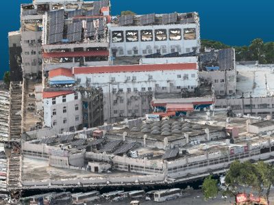
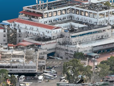
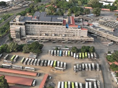
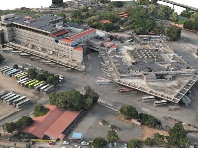
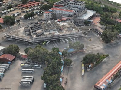
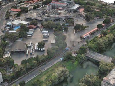
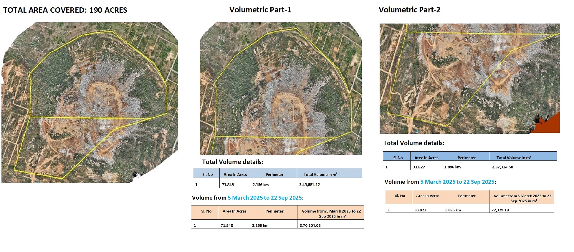
We provide advanced mesh modeling and 3D modeling services by converting drone and LiDAR data into detailed, realistic surface and structure models. Our team also performs precise LAS file editing and refinement, including classification correction, noise removal, and data optimization, to ensure clean, accurate point clouds. These outputs support visualization, engineering analysis, volumetric calculations, and high-end geospatial applications across infrastructure, mining, and planning projects.

LiDAR Point Cloud

3D Mesh Model

Volumetric Analysis for Terrain & Stockpiles

We deliver accurate terrain and stockpile volume calculations using drone and elevation data processed with engineering-grade workflows. Our outputs include clearly structured volume reports, cut–fill analysis, and supporting maps, ensuring transparency, traceability, and confidence for planning, billing, and project monitoring purposes.

A precision-driven geospatial services company providing dependable backend support for mapping, drone, and spatial projects across government and private sectors.

© 2026 Created with CloudHawk

Quick Links

Contacts

+91 9994894714

info.kaidronspatial@gmail.com